
Dolný Harmanec Japeň Staré Hory Majerova Skala Pod Líškou Krížna Ostredok Ostredok, rázc. Koniarky Chyžky Chata pod Borišovom Ploská s.Ploskej s. pod Čiernym kameňom Rakytovské s.(juž.) Rakytov Rakytovské s.(sev.) Močidlo, hot. Smrekovica Smrekovica, voj. zot. Nižné Šiprúnske s. s. pod Vtáčnikom Malina, hotel Vlkolínske lúky Sidorovo Kalvária Ružomberok nám. A. Hlinku
Click HERE
(source: hiking.sk)
Download GPX file
(source: hiking.sk)
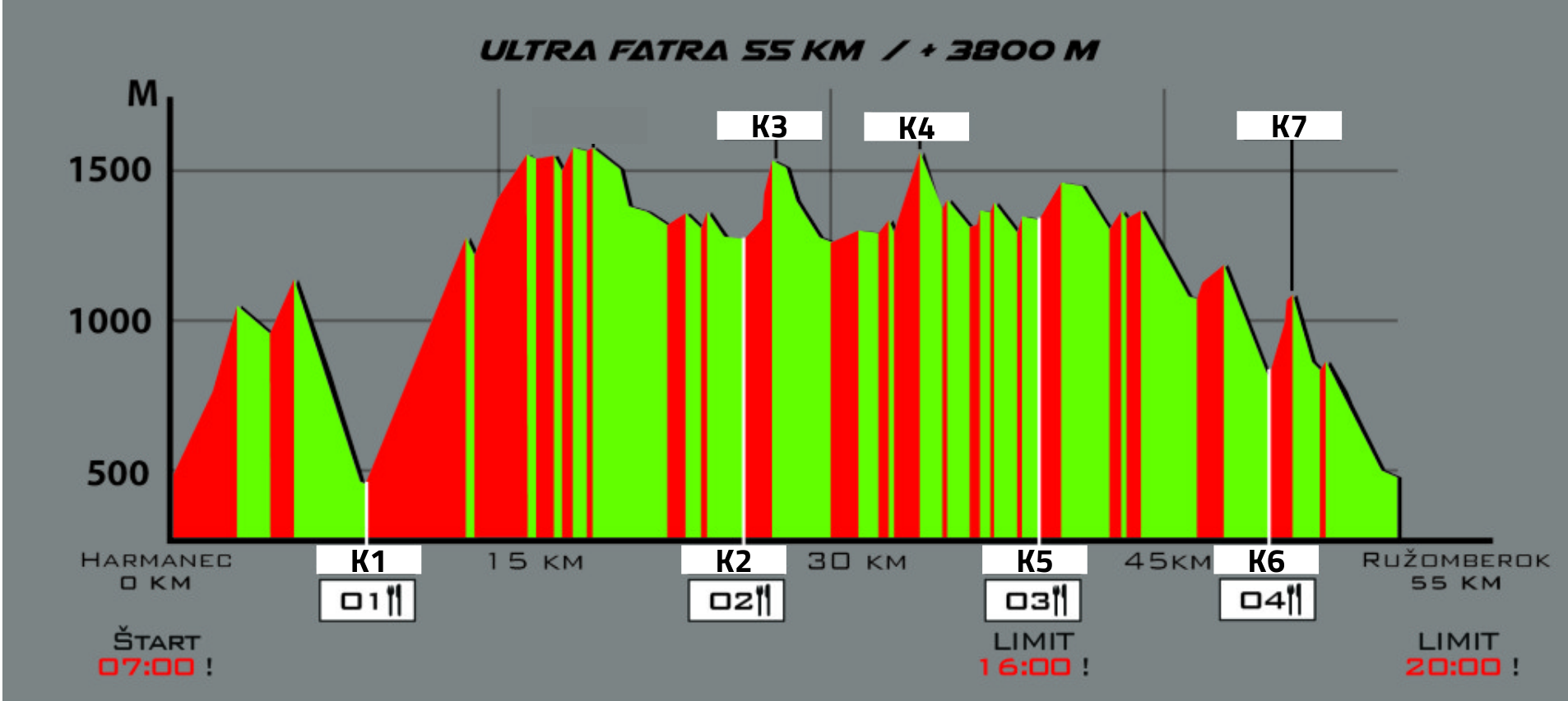
START – Dolný Harmanec 51
Time: 7:00
K1 + O1 + – Staré Hory village (8 km / + 730m)
K2 + O2 + – Chata pod Borišovom cottage (25 km / + 2210m)
K3 – Ploská hill (26 km / + 2460m)
K4 – Rakytov hill (33 km / + 2870m)
K5 + O3 + – Mountain hotel Granit Smrekovica (38 km/ + 3100m)
K6 + O4 + – Malinô Brdo Ski Center (47 km / + 3450m)
K7 – Sidorovo massif (49 km / + 3720m)
FINISH (54km / + 3770m)
QUICK NAVIGATION
Basic information Track Mandatory equipment Propositions Insurance Rules Results
Stanislava Plánka
00421 908 397 008
Filip Plánka
00420 777 457 072
Soňa Balážová
00421 915 050 024
IBAN: SK6183300000002301025235